Approximate Location Map
Large Map »
This site is entirely user-supported. See how you can help.
Latitude: 52.3968 / 52°23'48"N
Longitude: -3.1626 / 3°9'45"W
OS Eastings: 320990
OS Northings: 278279
OS Grid: SO209782
Mapcode National: GBR 9Z.Q41Q
Mapcode Global: VH68Z.40FY
Entry Name: Round Barrow S of Meagram's Corner
Scheduled Date:
Source: Cadw
Source ID: 737
Cadw Legacy ID: RD088
Schedule Class: Religious, Ritual and Funerary
Category: Round barrow
Period: Prehistoric
County: Shropshire
Civil Parish: Llanfair Waterdine
Traditional County: Radnorshire
Lieutenancy Area (Ceremonial County): Shropshire
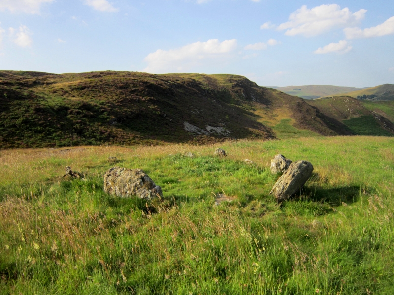
The monument comprises the remains of an earthen built round barrow, which probably date to the Bronze Age (c. 2300 - 800 BC). This barrow, also known as the Fedw Lwyd barrow, occupies comparatively low ground near the river Teme. It is circular in shape on plan, c.22m in diameter and has a rounded profile with a rather uneven surface, rising to a height of c.2m. A possible kerb of water-worn boulders was noted in an eroded area on its south side in the 1970s but has not been seen more recently.
The monument is of national importance for its potential to enhance our knowledge of prehistoric burial and ritual practices. The features are an important relic of a prehistoric funerary and ritual landscape and retain significant archaeological potential. There is a strong probability of the presence of both intact ritual and burial deposits, together with environmental and structural evidence. Barrows may be part of a larger cluster of monuments and their importance can further enhanced by their group value.
The scheduled area comprises the remains described and areas around them within which related evidence may be expected to survive.
Source: Cadw
Other nearby scheduled monuments