Approximate Location Map
Large Map »
This site is entirely user-supported. See how you can help.
Latitude: 52.9117 / 52°54'42"N
Longitude: -3.1111 / 3°6'39"W
OS Eastings: 325380
OS Northings: 335500
OS Grid: SJ253355
Mapcode National: GBR 71.NLS8
Mapcode Global: WH78K.52TM
Entry Name: Offa's Dyke: Section from Footpath S of Pen-y-Bryn to Orseddwen
Scheduled Date: 15 July 1930
Source: Cadw
Source ID: 2952
Cadw Legacy ID: DE136
Schedule Class: Monument
Category: Linear earthwork
Period: Early Medieval
County: Shropshire
Civil Parish: Weston Rhyn
Traditional County: Shropshire
Lieutenancy Area (Ceremonial County): Shropshire
Church of England Parish: Weston Rhyn St John
Church of England Diocese: Lichfield
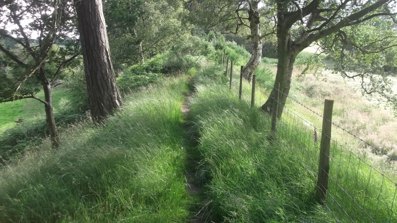
The monument consists of the remains of a length of Offa’s Dyke, a presumed 8th century AD defensive bank and ditch. It consists of a stretch of bank, with a ditch on the western side. This section of Offa’s Dyke climbs relatively steeply southward from the footpath south of Pen-y-Bryn. It passes between the two low summits east and west of Plas Crogen, before dropping down into the valley of Morlas Brook. The dyke then climbs again, passing to the west of Selattyn Hill to Orsedd Wen Farm.
This section of Offa’s Dyke forms the national boundary between England and Wales. It is crossed by several roads and tracks, and for much of its northern length it carries the Offa’s Dyke Path. It generally runs through cultivated and grazed agricultural land.
The monument is of national importance for its potential to enhance our knowledge of early medieval defensive organisation and settlement. It retains significant archaeological potential, with a strong probability of the presence of associated archaeological features and deposits. A dyke may be part of a larger cluster of monuments and their importance can be further enhanced by their group value.
The scheduled area comprises the remains described and the areas around them within which related evidence may be expected to survive.
Source: Cadw
Other nearby scheduled monuments