Approximate Location Map
Large Map »
This site is entirely user-supported. See how you can help.
Latitude: 52.5263 / 52°31'34"N
Longitude: -4.0416 / 4°2'29"W
OS Eastings: 261591
OS Northings: 294006
OS Grid: SN615940
Mapcode National: GBR 8T.FX4S
Mapcode Global: VH4DS.WRQQ
Entry Name: Hulks at Ynyslas, Ceredigion
Scheduled Date: 6 August 2015
Source: Cadw
Source ID: 970
Cadw Legacy ID: CD282
Schedule Class: Maritime
Category: Boat
Period: Post Medieval
County: Ceredigion
Community: Borth (Y Borth)
Traditional County: Cardiganshire
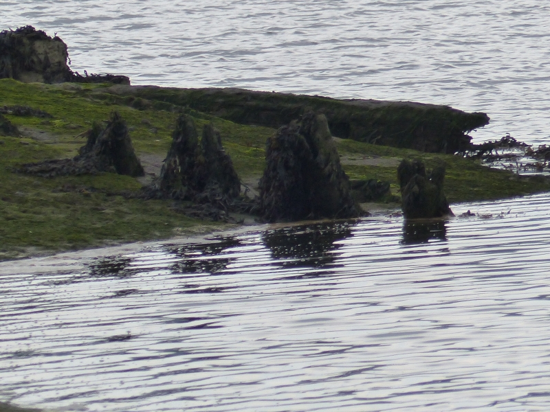
The monument comprises three hulks in the intertidal mud-flats, adjacent to the Afon Leri and part of the Ynyslas nature reserve. The three vessels probably date to the mid 19th century, and are thought to represent the remains of the Derwenlas fleet which largely fell out of use with the coming of the railways in the 1860s. Of the three vessels, item A is the most visible. It is eroding out of the steep-sided bank of the Leri, and demonstrating excellent preservation. Items B and C are still buried in the mud, with only the tops of timbers showing above ground to mark their locations. The positions of the vessels correspond with those shown on an Admiralty chart from the 1890s, there are suggestions that they were deliberately abandoned at the end of their working lives to mark the safe passage for shipping.
The three vessels are of national importance to inform us about local shipbuilding techniques, and to provide further information about the slate industry which was critical to the development and prosperity of the area. The anaerobic burial conditions mean that preservation is excellent, meaning that details of construction and use can be observed.
The Scheduled Area consists of three separate items, each representing the area of one of the vessels and a surrounding area within which associated evidence may be expected to survive.
Source: Cadw
Other nearby scheduled monuments