Approximate Location Map
Large Map »
This site is entirely user-supported. See how you can help.
Latitude: 52.2171 / 52°13'1"N
Longitude: -3.2729 / 3°16'22"W
OS Eastings: 313133
OS Northings: 258415
OS Grid: SO131584
Mapcode National: GBR YV.2DSJ
Mapcode Global: VH69P.7J3R
Entry Name: Graig Camp
Scheduled Date:
Source: Cadw
Source ID: 1953
Cadw Legacy ID: RD112
Schedule Class: Defence
Category: Hillfort
Period: Prehistoric
County: Powys
Community: Glascwm (Glasgwm)
Traditional County: Radnorshire
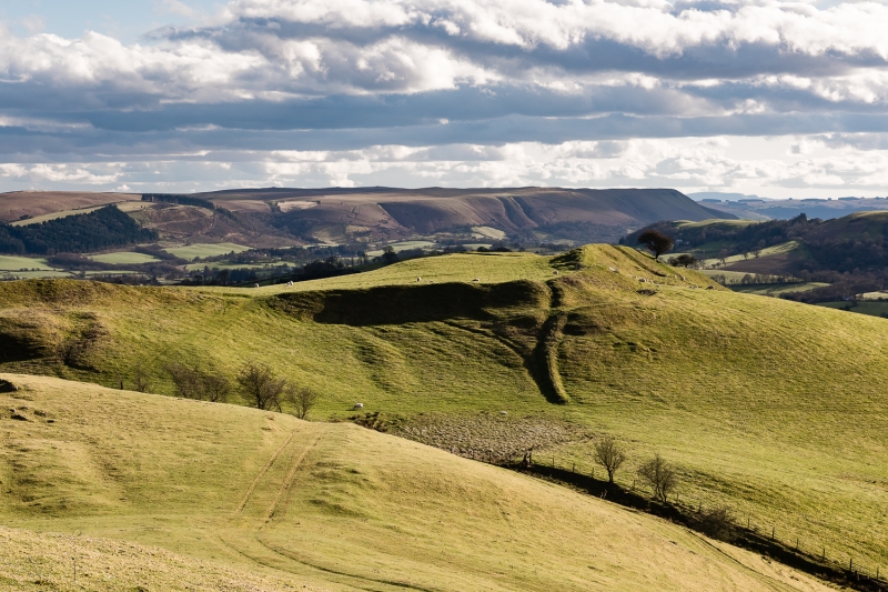
The monument comprises the remains of a hillfort, which probably dates to the Iron Age period (c. 800 BC - AD 74, the Roman conquest of Wales). Hillforts are usually located on hilltops and surrounded by a single or multiple earthworks of massive proportions. Hillforts must have formed symbols of power within the landscape, while their function may have had as much to do with ostentation and display as defence. Graig Camp occupies the final knoll of a ridge which stretches away to the north-east, the highest point being crowned by the north-western defences. The enclosure measures c.255m north-east to south-west by c.130m. Natural ridges of rock lie just outside the south-eastern defences where the steep slope has been artificially scarped, and also run into the enclosure on the south-west. In places the defences are surprisingly large, the bank on the north-east rising c.4.2m above the slight ditch and c.3.2m above the level of the interior. There is a simple entrance through the defences on the north-east, while another gap at the northern end of the north-western defences may not be original. The site has been under plough in the past and earthworks on the south-west, where none are now in evidence, may have been lost. Eight much later pillow mounds (for the raising of rabbits) recorded within the enclosure are now also much flattened and hard to make out; these are likely to have formed part of a single complex together with another group noted immediately to the north of the site.
The monument is of national importance for its potential to enhance our knowledge of later prehistoric defensive organisation and settlement. The site forms an important element within the wider later prehistoric context and within the surrounding landscape. The site is well preserved and retains considerable archaeological potential. There is a strong probability of the presence of evidence relating to chronology, building techniques and functional detail.
The scheduled area comprises the remains described and areas around them within which related evidence may be expected to survive.
Source: Cadw
Other nearby scheduled monuments