Approximate Location Map
Large Map »
This site is entirely user-supported. See how you can help.
Latitude: 53.1819 / 53°10'54"N
Longitude: -4.2867 / 4°17'11"W
OS Eastings: 247291
OS Northings: 367418
OS Grid: SH472674
Mapcode National: GBR 5H.3H6D
Mapcode Global: WH437.4901
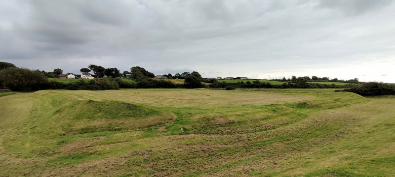
Entry Name: Caer Leb
Scheduled Date:
Source: Cadw
Source ID: 3248
Cadw Legacy ID: AN014
Schedule Class: Defence
Category: Enclosure
Period: Roman
County: Isle of Anglesey (Ynys Môn)
Community: Llanidan
Traditional County: Anglesey
The monument consists of the remains of an enclosure. It is of pentagonal shape measuring c. 61 m by 50 m enclosed by two banks and two ditches. The inner bank is well preserved and stands up to 2 m high; the outer bank survives only on the north west and south west sides. A modern field wall overlies the line of the outer bank on the south east side. A raised platform occupies the north east side of the interior. Excavations in 1866 revealed traces of a circular hut towards the south west side of the enclosure and the remains of rectangular structures against the south side. The rectangular structure is at least 14m square and the roundhouse has an internal diameter of 5.9 m. When the roundhouse was explored in 1866 it was found to have a paved floor with a stone mortar set at the centre and a possible hearth by the wall. The upper stone of a 'well finished' quern stone was also recovered from this building. Finds of late Roman date were recovered and included pottery, with some Samian Ware, a coin of the later third century emperor Postumus and a penannular brooch. This may be a later prehistoric settlement occupied through the Roman period. The presence of a groat of Henry V or VI may indicate some form of occupation in the medieval period.
The monument is of national importance for its potential to enhance our knowledge of later prehistoric defensive organisation and settlement. The site forms an important element within the wider later prehistoric context and within the surrounding landscape. The site is well preserved and retains considerable archaeological potential. There is a strong probability of the presence of evidence relating to chronology, building techniques and functional detail.
The scheduled area comprises the remains described and areas around them within which related evidence may be expected to survive.
Source: Cadw
Other nearby scheduled monuments