Approximate Location Map
Large Map »
This site is entirely user-supported. See how you can help.
Latitude: 55.978 / 55°58'40"N
Longitude: -4.9475 / 4°56'51"W
OS Eastings: 216186
OS Northings: 680034
OS Grid: NS161800
Mapcode National: GBR 04.WBJD
Mapcode Global: WH2M6.Z06J
Entry Name: Adam's Cave, chambered cairn, Ardnadam
Scheduled Date: 23 December 1996
Source: Historic Environment Scotland
Source ID: SM6552
Schedule Class: Cultural
Category: Prehistoric ritual and funerary: chambered cairn
Location: Dunoon and Kilmun
County: Argyll and Bute
Electoral Ward: Cowal
Traditional County: Argyllshire
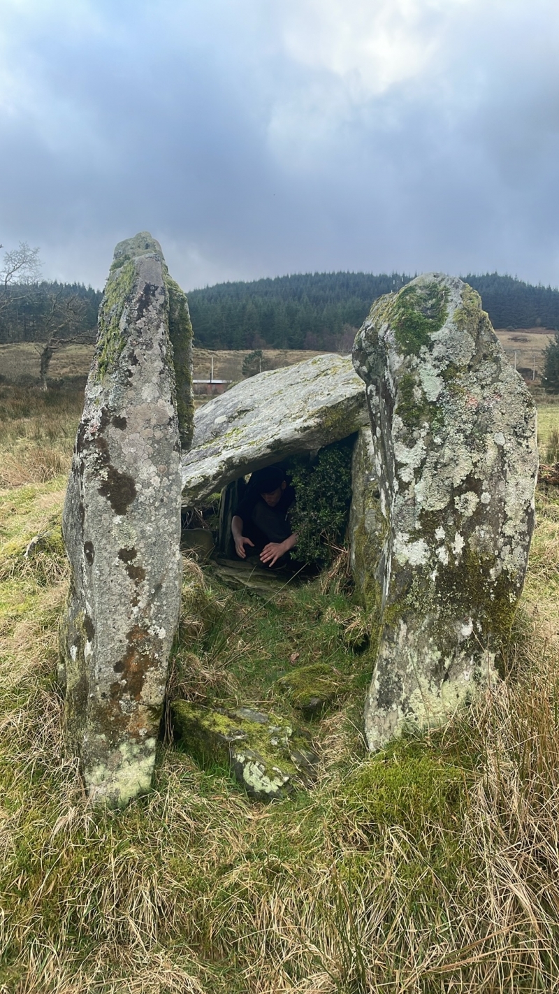
The monument, known locally as "Adam's Grave", comprises a Neolithic chambered burial cairn of the "Clyde-type".
The cairn body (measuring about 9.1m by 8.2m) is heavily robbed but survives to a height of about 1m. In the centre of the mound is an almost complete chamber (3.2m long) of schist slabs, entered from the NE between two tall pillar-like portal stones. One capstone survives. This chamber had been cleared out some time before 1845 and in the early twentieth century by Bryce, but on each occasion no finds were made.
The area to be scheduled is circular on plan and measures 50 m in diameter, to include the cairn and an area around in which associated remains may survive, as marked in red on the accompanying map extract.
Source: Historic Environment Scotland
The monument is of national importance because, despite later robbing, it retains well-preserved features characteristic of Neolithic burial monuments. As such it has the potential to provide evidence about the dating and development of every prehistoric burial practices, whilst the old ground surface which it seals is likely to contain evidence about the environment about 5,000 years ago, when the cairn was built. The cairn is also important because of its proximity (and potential relationship) to the Neolithic settlement at Ardnadam, one of the few Neolithic settlements to be recognised and excavated in southern Scotland.
Source: Historic Environment Scotland
Bibliography
RCAHMS records the monument as NS 18 SE 5.
Source: Historic Environment Scotland
Other nearby scheduled monuments