Approximate Location Map
Large Map »
This site is entirely user-supported. See how you can help.
Latitude: 57.4041 / 57°24'14"N
Longitude: -2.1325 / 2°7'56"W
OS Eastings: 392138
OS Northings: 834860
OS Grid: NJ921348
Mapcode National: GBR P924.ZQB
Mapcode Global: WH9PK.65S9
Entry Name: Candle Stone, standing stone 115m W of Drumwhindle House
Scheduled Date: 16 February 2009
Source: Historic Environment Scotland
Source ID: SM12447
Schedule Class: Cultural
Category: Prehistoric ritual and funerary: standing stone
Location: Ellon
County: Aberdeenshire
Electoral Ward: Ellon and District
Traditional County: Aberdeenshire
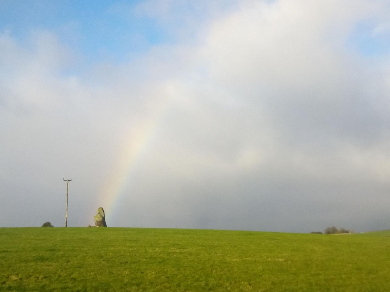
The monument comprises a single, large standing stone of likely late-neolithic or early Bronze-Age date. This upstanding monolith occupies a position approximately 55m above sea level on a level area of pasture land overlooking the Ebrie Burn, 700m to the east.
The earthfast whinstone is roughly 1m square on plan and around 2.5m in height. Towards its top, the stone widens to around 1.5m before tapering again to around 0.6m at its top. The stone's faces are aligned N/S and E/W. Recent field clearance lies around its base.
The area to be scheduled is circular on plan, centred on the stone, to include the remains described and an area around within which evidence relating to its construction and use may survive, as shown in red on the accompanying map.
Source: Historic Environment Scotland
Cultural Significance
The monument's cultural significance can be expressed as follows:
Intrinsic characteristics
This is a prominent, relatively large standing stone that apparently stands where it was originally erected. Buried deposits are likely to survive in the immediate area. Such deposits may also give us valuable information about the purpose of the monument, how and when it was erected, the people that used it and later activity that may be associated with it.
Contextual characteristics.
The monument is a good representative of a widespread class. It has the potential to contribute to a better understanding of standing stones, particularly those of the Strathdon area. This example is one of 50 or so in Strathdon where there has been a long tradition of the erection of standing stones and related monuments, such as stone circles and burial cairns. The RCAHMS have noted that the distribution of lone standing stones largely reflects the distribution of burial cairns, suggesting a link between the two. This not only suggests a preference for settlement in the area in prehistory, but also provides us with an extremely important opportunity to assess the distribution and relationships of such sites. Due to the near-absence of evidence for settlement sites from the neolithic or early Bronze Age in the Strathdon area, standing stones such as this are one of the main archaeological sources from which to understand the period and its socio-economic structure. The position of such monuments in the landscape is an apparently important factor in their location, as is their connection to other similar monuments. This particular example sits on the E shoulder of small hill, slightly off the summit and overlooking the Ebrie Burn near its confluence with the River Ythan. It also has very clear views to the south and north-east. Comparing and contrasting this monument with other examples of its type can give us valuable information on how and why the neolithic or Bronze-Age peoples of the area placed such monuments in the landscape. This can help us understand neolithic and Bronze-Age ritual monuments throughout Scotland, as well as in the Strathdon region.
National Importance
The monument is of national importance because it has an inherent potential to contribute to the understanding of the past, in particular neolithic and Bronze-Age standing stones and the part they played in ritual beliefs and practices. Spatial analysis of this and other contemporary monuments may reveal valuable information on the layout and patterns of neolithic or Bronze-Age ritual sites within the landscape. The loss of the monument would impede our understanding of the placing of such monuments within the landscape and the nature and purpose of their erection and use.
Source: Historic Environment Scotland
Bibliography
RCAHMS record the site as NJ93SW 1; Aberdeenshire SMR as NJ93SW 0001.
References:
Coles F R 1902, 'Report on stone circles in Aberdeenshire (Inverurie, Eastern Parishes and Insch Districts), with measured plans and drawings, obtained under the Gunning Fellowship', PROC SOC ANTIQ SCOT 37, 92-3.
Ritchie J 1926, 'Folklore of the Aberdeenshire stone circles and standing stones', PROC SOC ANTIQ SCOT 60, 313.
RCAHMS 2007, IN THE SHADOW OF BENNACHIE: A FIELD ARCHAEOLOGY OF DONSIDE, ABERDEENSHIRE, Edinburgh: Society of Antiquaries of Scotland.
Source: Historic Environment Scotland
Other nearby scheduled monuments