Approximate Location Map
Large Map »
This site is entirely user-supported. See how you can help.
Latitude: 56.1512 / 56°9'4"N
Longitude: -4.3991 / 4°23'56"W
OS Eastings: 251070
OS Northings: 697976
OS Grid: NS510979
Mapcode National: GBR 0T.JFQ8
Mapcode Global: WH3MN.DNF9
Entry Name: Blarnaboard, cup & ring marked rock 250m NE of
Scheduled Date: 17 November 1997
Source: Historic Environment Scotland
Source ID: SM7004
Schedule Class: Cultural
Category: Prehistoric ritual and funerary: cupmarks or cup-and-ring marks and similar rock art
Location: Aberfoyle
County: Stirling
Electoral Ward: Trossachs and Teith
Traditional County: Perthshire
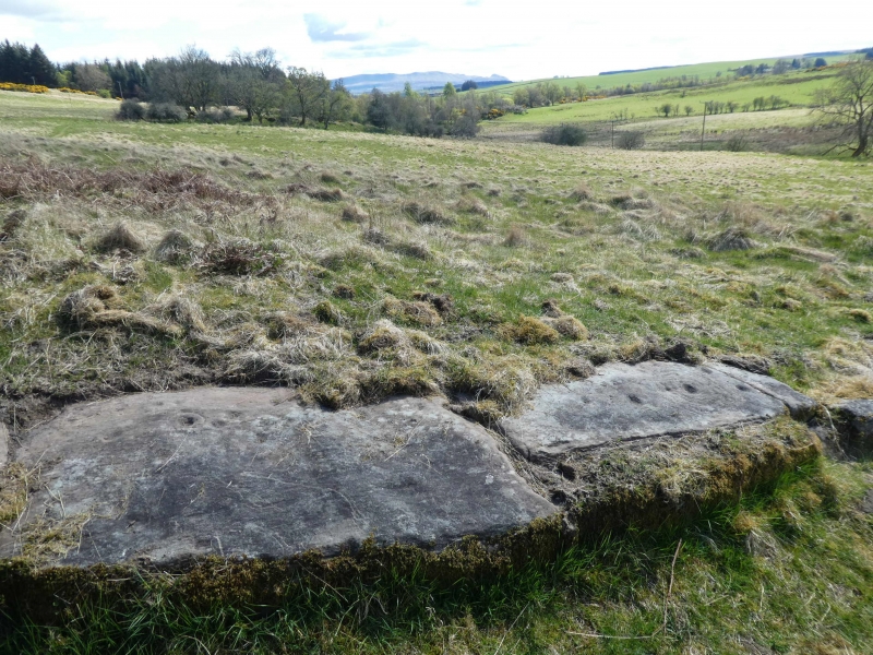
The monument comprises the remains of a cup and ring marked rock of prehistoric date.
The monument lies on a NE-facing rocky outcrop at around 75m OD. It comprises a group of carvings extending over a distance of about 7m. These take the form of numerous cup-like depressions, some surrounded by concentric rings. Cup and ring mark carvings appear to date principally to the Bronze Age and may have marked areas of ritual and religious significance.
The area to be scheduled encompasses the carvings and an area around them in which traces of associated activity may be expected to survive. It is sub-circular with a maximum diameter of 35m as marked in red on the accompanying map extract.
Source: Historic Environment Scotland
The monument is of national importance because of its potential to contribute to our understanding of prehistoric ritual practices.
Source: Historic Environment Scotland
Bibliography
RCAHMS records the monument as NS 59 NW 18.
Source: Historic Environment Scotland
Other nearby scheduled monuments