Approximate Location Map
Large Map »
This site is entirely user-supported. See how you can help.
Latitude: 53.1544 / 53°9'15"N
Longitude: -0.6362 / 0°38'10"W
OS Eastings: 491293.650379
OS Northings: 362787.680219
OS Grid: SK912627
Mapcode National: GBR DM7.7YW
Mapcode Global: WHGJB.6Z94
Entry Name: Hall Close: a medieval and post-medieval hall complex south of Dovecote Lane, with dovecote, gardens, fishponds, churchyard and cultivation remains
Scheduled Date: 8 September 2003
Source: Historic England
Source ID: 1021080
English Heritage Legacy ID: 22771
County: Lincolnshire
Civil Parish: Aubourn with Haddington
Traditional County: Lincolnshire
Lieutenancy Area (Ceremonial County): Lincolnshire
Church of England Parish: The Withamside United Parish
Church of England Diocese: Lincoln
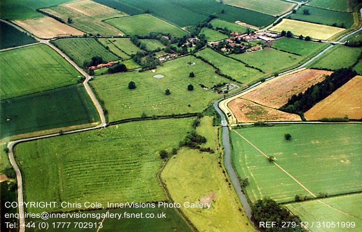
The monument includes Hall Close, an area of over 11ha situated between
Dovecote Lane and the River Witham. Hall Close is the site of Haddington
Hall, an early 17th century manor house of the Nevile family. The Hall and its
formal gardens incorporated the remains of two earlier manor houses, West Hall
and East Hall, which were acquired by the Neviles in 1575 and 1604
respectively. After 1628, when the Neviles bought the manor at Aubourn and
moved to Aubourn Hall, Haddington Hall was leased out until at least 1675. By
the mid-18th century it appears to have fallen into disrepair. An estate map
of 1850 shows that a number of buildings formerly part of the hall complex
were still standing, including the dovecote, which was still in use at that
time. In the mid-20th century the roof of the dovecote blew down and the
remaining buildings were demolished. The scheduling includes the standing
remains of the dovecote, the earthwork and buried remains of Haddington Hall
and the manor houses which preceded it, together with associated gardens,
moated fishponds and cultivation remains; it also includes underlying
settlement remains of early medieval date and the site of the medieval chapel
of St Nicholas, which stood at the north eastern corner of the monument.
At the time of the Domesday Book there were two holdings in Haddington; that
of the soke of the manor of Aubourn was held by Robert de Todeni of Belvoir,
and the other, held by Ailric of the soke of the manor of Doddington Pigot,
passed to the honour of Wake, barons of Bourne. The Belvoir holding is
associated with East Hall, attached to Aubourn parish, and the Wake holding
with West Hall, attached to South Hykeham parish. By the mid-13th century
these holdings had become fragmented, and in 1504 there was only one manor in
Haddington. In the 15th century the site is referred to as `Westhall
Garthes', and in 1554 the first reference is made to a dovecote, owned by
William Badger, who occupied East Hall. The present dovecote may have
originated at this time, although it may equally represent a rebuilding
associated with the establishment of Haddington Hall in the late 16th or early
17th century.
The dovecote is a stone structure 6 sq m in plan, now unroofed. The walls are
constructed of roughly-dressed limestone laid in courses, now standing to
a height of 3.5m and resting on a foundation of large undressed limestone
blocks. At a height of about 2m is a projecting string-course which served
to deter vermin. In the east wall is a low doorway which gave access to the
interior; a window-like opening in the north wall is a modern construction.
The interior of the dovecote now contains about 450-500 nest boxes, also
constructed of limestone, with square openings and projecting flight ledges.
In the early 20th century the dovecote is thought to have had a tiled
pyramidal roof with a louvred flight-hole at the apex.
The dovecote stands near the centre of a broad rectangular platform, about
100m by 70m, which extends along the south side of Dovecote Lane. Until the
mid-20th century this area was occupied by a series of farm buildings and
cottages believed to have originated as part of the Haddington Hall complex.
It is bounded on the south by a ditch and later pond, and on the east by a
sunken trackway extending southwards from Dovecote Lane. This trackway
represents the central access to the complex. It leads to a second platform,
about 80m by 70m, adjacent to the south of the first, on which is a series of
substantial earthworks representing the buried remains of a rectangular
building, about 60m long by 20m wide and aligned north-south, partly cut into
by the later pond. A third enclosure adjacent to the east, also about 80m by
70m, includes further rectilinear building remains aligned east-west, together
with a sunken yard. This series of earthworks is thought to represent
Haddington Hall, which in 1658 was described as having a library, hall,
kitchen, pantry, dairy, three chambers, a closet, brewhouse and stables. This
suggests a much larger complex than that of West Hall described 70 years
earlier, which had a hall, parlour, kitchen, larder and pantry, two chambers
upstairs and a bakehouse and milkhouse at the rear. Haddington Hall and its
service buildings may therefore represent a substantial rebuilding of the
sites of both East Hall and West Hall, which are thought to have been located
on the east and west sides of the trackway respectively.
To the north of the sunken yard is a fourth enclosure, about 80 sq m, which
completes the group of rectangular enclosures centred on the trackway. It is
subdivided into smaller enclosures, thought to have been used for cultivation
and paddocks; that immediately adjacent to the trackway includes traces of
ridged cultivation, possibly of earlier date, while that to the west includes
a pond of modern origin. A second trackway separates these two enclosures
from a raised area adjacent to Dovecote Lane where buried remains of dwellings
are believed to be located. Limited archaeological investigation in the north
eastern part of the monument revealed evidence of settlement in the Anglo-
Saxon period.
In the north eastern corner of the monument is the site of the chapel of St
Nicholas, first referred to in 1233 as dependent on the church of St Michael
at South Hykeham. In the late 13th century it was given to the nunnery of St
Nicholas at Torksey. It is last known to have been used in 1775, and had been
demolished by 1850 when an estate map marked the extent of the former
churchyard, a rectangular area about 30m wide and 40m long. At the northern
end of the churchyard is a raised platform measuring about 10m by 30m and
aligned east-west; this is thought to represent the location of the buried
remains of the chapel.
The complex of enclosures associated with Haddington Hall can thus be seen to
occupy an area over 150 sq m immediately south of Dovecote Lane. Further
south, however, is another series of earthworks representing the remains of
the formal gardens associated with the hall. A rectangular embanked enclosure,
about 70m long and 60m wide, extends southwards from the remains of the hall
down the natural slope towards the river. In its southern half is a central
mound, about 0.8m high and 5m in diameter, thought to represent a prospect
mound. The banks and ditches on the east and west sides of this garden extend
southwards to the edge of the river where they enclose a moated site
containing two linear fishponds. The moat is 8m-13m wide and 1.7m deep,
enclosing a rectangular island about 30m by 40m within which the two ponds are
located, 30m long and aligned east-west. This fishpond complex is believed to
be medieval in origin, constructed in the former course of the river in
association with one of the medieval manors at Haddington. It was later
incorporated into the formal garden layout established south of Haddington
Hall, probably in the early 17th century, with the addition of an outer `moat'
or ornamental canal along its western side.
Immediately west of the moated fishpond complex and garden earthworks is an
area of ridge-and-furrow cultivation; the ridges are aligned approximately
north-south and are about 6m in width. Adjacent to the west of this furlong,
and occupying the whole of the western part of Hall Close, is a much larger
furlong aligned north west-south east, in which the ridges are 7m-8m wide and
0.5m high. A linear bank running along the western edge of Hall Close
represents a headland which also served as an access track. The northern part
of this furlong has been altered by post-medieval and modern activity adjacent
to the former farm buildings, including access trackways, ponds and drainage
channels.
All fences, gates and information boards are excluded from the scheduling,
although the ground beneath them is included.
MAP EXTRACT
The site of the monument is shown on the attached map extract.
Source: Historic England
Medieval manorial settlements supported communities primarily devoted to
agriculture, and acted as the foci for manorial administration. These
settlements provide information on the diversity of medieval settlement
patterns and farming economy, and on the structure and changing fortunes of
manorial communities. The remains of the two medieval manors at Haddington
are associated with both earlier settlement, as indicated by the presence of
Anglo-Saxon remains, and later settlement, in the form of Haddington Hall; the
site therefore represents a rare survival of well-preserved settlement remains
extending over a period of more than a thousand years. In conjunction with the
ridge-and-furrow of its surrounding fields, the site will tell us how the
settlement developed, both economically and socially, over a long period. As
a result of extensive historical research these features are quite well
understood. They survive well in the form of substantial earthworks and buried
deposits, and limited activity in modern times means that archaeological
remains will survive relatively undisturbed.
The dovecote associated with Haddington Hall survives well as a structure, the
only building of the settlement complex to remain above ground.
Dovecotes are specialised structures designed for the breeding and keeping of
doves as a source of food and as a symbol of high social status; they are thus
frequently sited at manor houses and monasteries. Most surviving dovecotes are
considered to be of national interest; they are also generally regarded as an
important component of local distinctiveness and character.
The medieval chapel of St Nicholas at Haddington was one of around 4000
parochial chapels built in England between the 12th and 17th centuries.
Parochial chapels served as subsidiary places of worship for the convenience
of parishioners who lived at a distance from the main parish church. Other
chapels were built as private places of worship by manorial lords and lie near
or within manor houses, castles or other high-status residences. Some chapels
possessed burial grounds. Unlike parish churches, the majority of which
remain in ecclesiastical use, chapels were often abandoned as their
communities and supporting finances declined or disappeared. In common with
parish churches, however, they have always been major features of the
landscape. A significant number of surviving examples are therefore
identified as being nationally important. The sites of abandoned chapels,
where positively identified, are particularly worthy of statutory protection
as they were often left largely undisturbed and thus retain important
information about the nature and date of their use up to their abandonment.
The medieval and post-medieval settlement remains at Hall Close are also
associated with those of a fishpond complex. A fishpond is an artificially
created pool of slow-moving freshwater constructed for the purpose of
cultivating, breeding and storing fish to provide a constant and sustainable
supply of food. The size of the pond was related to function, with large
ponds thought to have had a storage capability whilst smaller, shallower ponds
were used for fish cultivation and breeding; islands were used for fishing,
wildfowl management or as shallow spawning areas. The tradition of
constructing and using fishponds in England began during the medieval period
and peaked in the 12th century. They were largely built by the wealthy sectors
of society; most were located close to villages, manors or monasteries or
within parks so that a watch could be kept on them to prevent poaching. Most
fishponds fell out of use during the post-medieval period, although some were
reused as ornamental features. Although approximately 2000 examples are
recorded nationally, this is thought to be only a small proportion of those in
existence in medieval times. Surviving examples are considered to be important
for the information they preserve about economy, society and environment at
relatively high-status sites.
The fishponds at Hall Close are set within a formal garden of the early 17th
century. Gardens have a long history in England. The major development in
gardening took place in the late medieval and early post-medieval periods when
the idea of the garden as a `pleasure ground' developed. Some involved
significant water-management works to create elaborate water gardens which
could include a series of ponds and even ornamental canal systems. At other
sites, flower gardens were favoured, with planting in elaborately shaped and
often geometrically laid out beds; buried remains may include details of the
planting patterns, and even environmental material from which to identify the
species employed. Such sites were often provided with raised walkways or
prospect mounds which provided vantage points from which the garden design and
layout could be seen and fully appreciated. Garden design often mirrors
elements of the design of the associated house, particularly following the
symmetry of the buildings; walled closes of stone or brick sometimes also
served as the forecourt of the main house. Formal gardens were created as a
routine accompaniment of the country seats of the landed elite, and thus have
a particular importance reflecting the social expectations and aspirations of
the period. They provide a valuable insight into contemporary aesthetics and
views about how the landscape could be modified to enhance the surroundings of
a house and symbolise social hierarchy. In view of the rarity of surviving
examples, and their importance for understanding high-status houses and their
occupants, formal gardens are normally considered to be of national importance
where the principal features remain visible, or where significant buried
remains survive. When no longer in use they are considered for scheduling.
Source: Historic England
Other nearby scheduled monuments