Approximate Location Map
Large Map »
This site is entirely user-supported. See how you can help.
Latitude: 52.1032 / 52°6'11"N
Longitude: -0.3311 / 0°19'51"W
OS Eastings: 514401.946946
OS Northings: 246303.876413
OS Grid: TL144463
Mapcode National: GBR H42.13W
Mapcode Global: VHGMZ.6DTH
Entry Name: Medieval fishery and warren in Home Wood
Scheduled Date: 2 December 1998
Source: Historic England
Source ID: 1018455
English Heritage Legacy ID: 29423
County: Central Bedfordshire
Civil Parish: Northill
Traditional County: Bedfordshire
Lieutenancy Area (Ceremonial County): Bedfordshire
Church of England Parish: Northill
Church of England Diocese: St.Albans
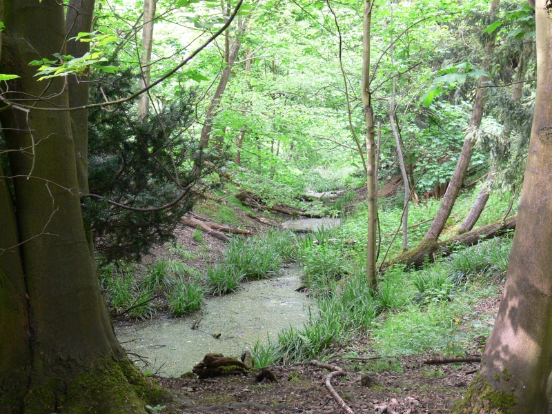
The monument includes the visible and buried remains of a medieval fishpond
and warren complex located within a small valley to the west of the village of
Northill, some 550m south west of St Mary's Church.
The complex is defined by a broad ditch surrounding a roughly rectangular
island orientated NNW-SSE in line with the valley floor. The western arm of
the perimeter ditch is 10m-12m wide and some 170m in length, water-filled from
springs on the valley floor, and flanked by a slight outer bank which is
thought to have resulted from periodic dredging during the period of use. The
eastern arm is similar in width but different in character, with a more
pronounced `V'-shaped profile cut into the rising ground to a depth of 3m. It
is now normally dry. A substantial internal bank created from the upcast
follows the entire length, rising to a pronounced knoll at the southern end.
The western halves of the southern and northern arms remain waterfilled or
waterlogged for much of the year. These are generally no more than 6m in
width, although the western part of the northern ditch appears to have been
widened prior to 1781 - the date of the earliest known large scale map of the
area. Between 1781 and 1884 a linear pond was added to the north west corner
of the perimeter ditch. This pond has since been enlarged and extended further
to the north. It is not included in the scheduling.
The island is divided in two lengthways by a broad central ditch and the
western half is further sub-divided into three rectangular compartments, each
surrounded by interconnecting ditches and containing arrangements of between
three and four narrow rectangular fishponds. Narrow breaches in the inner face
of the perimeter ditch and junctions with the main central channel indicate
the means by which the flow of water through this system was originally
regulated. The ponds and connecting ditches vary between 0.5m and 1m in depth
and contain considerable deposits of waterlogged silt and leaf mould.
The eastern side of the island is generally level and may have contained a
dwelling for the keeper and other buildings related to the management of the
fishery. It has also been suggested that this side saw use as a managed rabbit
warren, with the level area acting as warren pasture and the large internal
bank and knoll to the east serving as a purpose-built nesting area or pillow
mound. The surrounding ditch, when fully wet, would have provided an effective
means of confining the rabbit population, the only point of access being a
narrow causeway across the northern arm which may well be a later addition.
The original entrance is thought to have been a bridge, the location of which
is marked by a gap in the internal bank near the centre of the eastern arm.
The complex is believed to have been attached to the medieval estate of
Northill Manor, which was located on the crest of the slope to the east,
slightly to the west of the church. It certainly formed part of the Manor's
property by the late 18th century, although it is not known whether it was
still actively managed at that time.
MAP EXTRACT
The site of the monument is shown on the attached map extract.
It includes a 2 metre boundary around the archaeological features,
considered to be essential for the monument's support and preservation.
Source: Historic England
A fishpond is an artificially created pool of slow moving freshwater
constructed for the purpose of cultivating, breeding and storing fish to
provide a constant and sustainable supply of food. They may be dug into the
ground, embanked above ground level, or formed by placing a dam across a
narrow valley. Groups of up to twelve ponds variously arranged in a single
line or in a cluster and joined by leats have been recorded. The ponds may be
of the same size or of several different sizes with each pond being stocked
with different species or ages of fish. The size of the pond was related to
function, with large ponds thought to have had a storage capability whilst
smaller, shallower ponds were used for fish cultivation and breeding.
Fishponds were maintained by a water management system which included inlet
and outlet channels carrying water from a river or stream, a series of sluices
set into the bottom of the dam and along the channels and leats, and an
overflow leat which controlled fluctuations in water flow and prevented
flooding.
Buildings for use by fishermen or for the storage of equipment, and islands
possibly used for fishing, wildfowl management or as shallow spawning areas,
are also recorded.
The tradition of constructing and using fishponds in England began during the
medieval period and peaked in the 12th century. They were largely built by the
wealthy sectors of society with monastic institutions and royal residences
often having large and complex fishponds. The difficulties of obtaining fresh
meat in the winter and the value placed on fish in terms of its protein
content and as a status food may have been factors which favoured the
development of fishponds and which made them so valuable. The practice of
constructing fishponds declined after the Dissolution of the Monasteries in
the 16th century although in some areas it continued into the 17th century.
Most fishponds fell out of use during the post-medieval period although some
were re-used as ornamental features in 19th and early 20th century landscape
parks or gardens, or as watercress beds.
Documentary sources provide a wealth of information about the way fishponds
were stocked and managed. The main species of fish kept were eel, tench,
pickerel, bream, perch, and roach. Large quantities of fish could be supplied
at a time. Once a year, probably in the spring, ponds were drained and
cleared.
Fishponds are widely scattered throughout England and extend into Scotland and
Wales. The majority are found in central, eastern and southern parts and in
areas with heavy clay soils. Fewer fishponds are found in coastal areas and
parts of the country rich in natural lakes and streams where other sources of
fresh fish were available. Although 17th century manuals suggest that areas of
waste ground were suitable for fishponds, in practice it appears that most
fishponds were located close to villages, manors or monasteries or within
parks so that a watch could be kept on them to prevent poaching. Although
approximately 2000 examples are recorded nationally, this is thought to be
only a small proportion of those in existence in medieval times. Despite being
relatively common, fishponds are important for their associations with other
classes of medieval monument and in providing evidence of site economy.
The largely undisturbed fishery complex in Home Wood is exceptionally well
preserved, retaining visible evidence of all the major components which made
up the stock and water management systems on the site. It is all the more
interesting on account of its unusual size for a manorial (as opposed to
monastic) property, and its comparative isolation from the settlement to which
it belonged. The partly buried channels and ponds will provide detailed
information concerning the water management system, and contain waterlogged
deposits from which both artefacts and environmental evidence can be retrieved
to illustrate the development of the site, and the landscape in which it was
set. The island may also retain buried information for structures associated
with the operation of the fishery, as well as the warren which is thought to
have occupied the eastern side.
Rabbit warrens, like fishponds, were devised in order to provide a constant
supply of fresh meat. The pelts, of course, were also of considerable value.
The tradition of constructing artificial warrens dates from the 12th century,
following the introduction of rabbits into England from the continent. Warrens
usually contain artificial breeding places, known as pillow mounds or rabbit
buries, which were intended to centralise the colony and make catching the
animals easier, whether by using nets, ferrets or dogs. Many warrens were also
enclosed by walls, ditches, banks or hedges in order to contain and protect
the stock; larger warrens might even include living quarters for the warrener
who kept charge of the site. Early warrens were mostly associated with the
higher levels of society; however, they gradually spread in popularity so that
by the 16th and 17th centuries they were a common feature of manors and
estates throughout the country. The practice declined in the 18th century as a
result of the increased availability of imported furs, and ultimately ceased
as a result of changes in agricultural practice in the 19th and early 20th
century. Warrens may provide evidence of the economy of both secular and
ecclesiastical estates, especially when associated with other forms of
husbandry such as deer parks, field systems and fishponds. All well preserved
medieval examples are considered worthy of protection.
The earthworks in Home Wood include evidence for the establishment of a
sizeable artificial warren alongside the fishpond complex, utilising the
upcast from the ditch which served both as part of the water management system
and as the warren boundary. Taking both aspects together, the complex
represents a significant component of the medieval landscape created to
support the economy of the manor, and provides a graphic illustration of the
sophistication of medieval husbandry.
Source: Historic England
Books and journals
Bigmore, P, Beds And Hunts Landscape, (1979)
Simco, A, Medieval fishery, Home Wood, Northill, (1988)
Simco, A, Medieval fishery, Home Wood, Northill, (1988)
Simco, A, Medieval fishery, Home Wood, Northill, (1988)
Marson, F W, 'Bedfordshire Magazine' in Northill: Village of the Ivel Valley, , Vol. Vol 1, (1960), 142
Other
Notes on discoveries in 1949 & 1986, Simco, A, Home Wood, Northill, (1988)
Title: BRO X1/87 Map of Northill
Source Date: 1781
Author:
Publisher:
Surveyor:
Beds Record Office
Title: Ordnance Survey 25" Series
Source Date: 1884
Author:
Publisher:
Surveyor:
Source: Historic England
Other nearby scheduled monuments