Approximate Location Map
Large Map »
This site is entirely user-supported. See how you can help.
Latitude: 52.6608 / 52°39'38"N
Longitude: -1.1284 / 1°7'42"W
OS Eastings: 459051.02738
OS Northings: 307367.699005
OS Grid: SK590073
Mapcode National: GBR FH8.V1
Mapcode Global: WHDJB.MCWZ
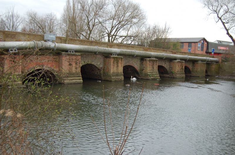
Entry Name: The 'Roman' bridge, Belgrave
Scheduled Date:
Source: Historic England
Source ID: 1005077
English Heritage Legacy ID: LC 31
County: Leicester
Electoral Ward/Division: Abbey
Built-Up Area: Leicester
Traditional County: Leicestershire
Lieutenancy Area (Ceremonial County): Leicestershire
Church of England Parish: The Resurrection
Church of England Diocese: Leicester
This record has been generated from an "old county number" (OCN) scheduling record. These are monuments that were not reviewed under the Monuments Protection Programme and are some of our oldest designation records. As such they do not yet have the full descriptions of their modernised counterparts available. Please contact us if you would like further information.
Source: Historic England
Other nearby scheduled monuments