Approximate Location Map
Large Map »
This site is entirely user-supported. See how you can help.
Latitude: 52.4473 / 52°26'50"N
Longitude: 0.8772 / 0°52'38"E
OS Eastings: 595629.024669
OS Northings: 287157.385192
OS Grid: TL956871
Mapcode National: GBR SFC.DMJ
Mapcode Global: VHKC8.5R37
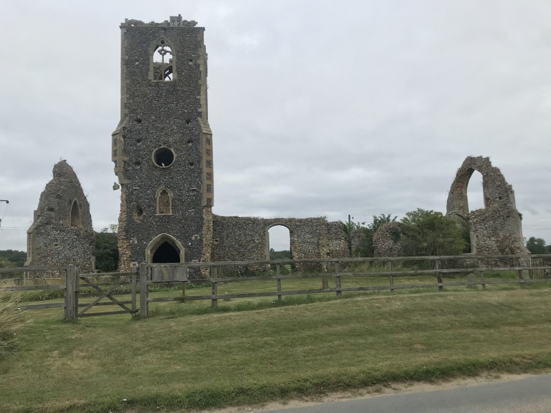
Entry Name: Ruins of St Andrew's Church
Scheduled Date:
Source: Historic England
Source ID: 1004012
English Heritage Legacy ID: NF 87
County: Norfolk
Civil Parish: Roudham and Larling
Traditional County: Norfolk
Lieutenancy Area (Ceremonial County): Norfolk
Church of England Parish: Bridgham St Mary
Church of England Diocese: Norwich
This record has been generated from an "old county number" (OCN) scheduling record. These are monuments that were not reviewed under the Monuments Protection Programme and are some of our oldest designation records. As such they do not yet have the full descriptions of their modernised counterparts available. Please contact us if you would like further information.
Source: Historic England
Other nearby scheduled monuments