Approximate Location Map
Large Map »
This site is entirely user-supported. See how you can help.
Latitude: 52.7489 / 52°44'55"N
Longitude: 0.3969 / 0°23'49"E
OS Eastings: 561880.186351
OS Northings: 319499.811903
OS Grid: TF618194
Mapcode National: GBR N3Q.R4S
Mapcode Global: WHJP7.259H
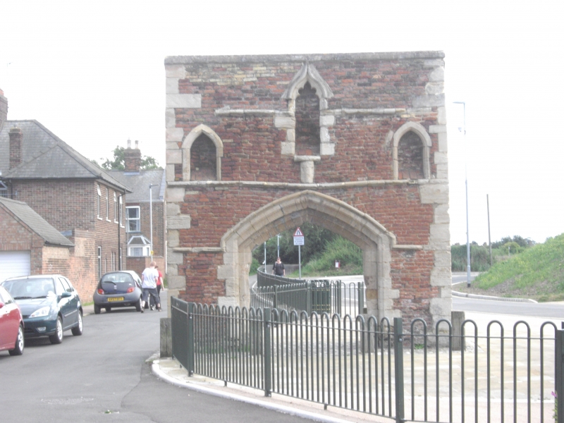
Entry Name: Whitefriars Gateway, South Lynn
Scheduled Date:
Source: Historic England
Source ID: 1003693
English Heritage Legacy ID: NF 178
County: Norfolk
Electoral Ward/Division: St Margarets with St Nicholas
Built-Up Area: King's Lynn
Traditional County: Norfolk
Lieutenancy Area (Ceremonial County): Norfolk
This record has been generated from an "old county number" (OCN) scheduling record. These are monuments that were not reviewed under the Monuments Protection Programme and are some of our oldest designation records. As such they do not yet have the full descriptions of their modernised counterparts available. Please contact us if you would like further information.
Source: Historic England
Other nearby scheduled monuments