Approximate Location Map
Large Map »
This site is entirely user-supported. See how you can help.
Latitude: 50.8216 / 50°49'17"N
Longitude: -1.4502 / 1°27'0"W
OS Eastings: 438825.710888
OS Northings: 102598.716629
OS Grid: SU388025
Mapcode National: GBR 77G.D5L
Mapcode Global: FRA 76VX.NW0
Entry Name: Beaulieu Abbey
Scheduled Date: 13 January 1915
Last Amended: 23 January 2015
Source: Historic England
Source ID: 1003450
English Heritage Legacy ID: HA 8
County: Hampshire
Civil Parish: Beaulieu
Traditional County: Hampshire
Lieutenancy Area (Ceremonial County): Hampshire
Church of England Parish: Beaulieu Blessed Virgin and Holy Child
Church of England Diocese: Winchester
The upstanding remains, earthworks and buried remains of a medieval Cistercian abbey.
Source: Historic England
PRINCIPAL ELEMENTS
The upstanding remains, earthworks and buried remains of a Cistercian abbey, known as Beaulieu. It is situated near a bend in the Beaulieu River, at the south-east of the New Forest.
PRECINCT BOUNDARY AND LAYOUT
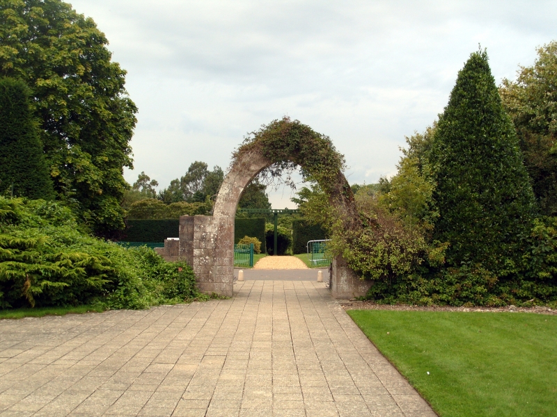
The monastic precinct at Beaulieu Abbey embraced a broadly square area of about 58 acres. It was defined by a wall of which eight lengths now remain upstanding, all of which are listed. This wall was built of rubble stone to about 3m high and 0.8m thick with a gabled coping of inclined stones. The entrance into the precinct was at the south-east corner, next to the Beaulieu River, through an outer gatehouse. This remains upstanding and is Grade II* listed. Beyond the outer gatehouse was a narrow courtyard formed by a lane running northwards with buildings each side leading to an inner gatehouse. The inner or ‘Great Gatehouse’ now forms part of Palace House. Beyond it was the ‘Great Court’ of the abbey containing the guest houses, stables, brewhouse, bakehouse and other buildings. On the east side of this court was the claustral complex, including the church, cloister, domestic accommodation and infirmary.
THE CLAUSTRAL PLAN
The ground plan of the claustral complex is typically Cistercian, and was influenced directly by French models. It consisted of a large abbey church at the north and domestic buildings surrounding a cloister immediately south of the nave. In a clockwise direction these comprised: an east range with a vestry, chapter house, slype (covered passage), monks’ dorter (dormitory) and reredorter (communal latrine); a south range with a warming house, lavatory, monks frater (refectory) and kitchen; and a west range with the cellar, lay-brothers’ frater and lay-brothers’ dorter. To the east of the east range of the cloister was an infirmary hall with chapel, a misericord (a chamber in which the monastic rule was relaxed, particularly with regard to eating meat) and a kitchen.
THE CHURCH
The monastic church, which is 102m long and 57m wide across the transepts, survives as upstanding and buried remains. It is among the very largest of Cistercian churches and was highly reminiscent of the Order’s mother church at Cîteaux. Although a large part of the church was demolished after the Dissolution, the footings of the walls and piers of much of the building survive and have been traced and marked out in rubble. It consists of an aisled nave of nine bays, an aisled chancel surrounded by a ring of ten chapels (although the remains at the extreme east end have been removed), and north and south transepts each with an eastern aisle containing three more chapels. The north transept is broader and longer than the south and possesses a western as well as an eastern aisle, and a galilee (a chapel or porch at the entrance to a church) north of its north wall. At the west end of the nave is another galilee.
The upstanding remains of the church include the south aisle wall and the west wall of the south transept, against which are the monks’ night-stairs that originally led to the first floor dorter of the east range. The walls, like those of the rest of the claustral complex, are built of dressed and coursed Caen and Binstead stone with a rubble stone core. The south aisle wall is 3m thick and was formed of eight bays internally, divided by vaulting shafts of which only the springings now survive. In the seventh bay (from the east) is a doorway leading out onto a courtyard next to the cloister. It is formed of a segmental arch supported by shafts with carved capitals. The external wall of the south aisle forms the north wall of the cloister. It is ashlar-faced and has a blind arcade of seven pointed arch recesses. Above these are two rows of corbels, which originally supported the roof of the cloister walk. At the eastern end of the nave is a pointed arch doorway into the church formed of three moulded orders, which spring from carved capitals.
THE EAST RANGE
The east range of the cloister extends from the south transept of the church. A large part of the west wall and cross walls of this range remain upstanding. At the northern end of the west wall, near the doorway into the church, is a pointed arched recess. Further south is a rectangular vaulted chamber with moulded ribs springing from shafts with foliated capitals. This chamber originally served as the common bookcase, where books were kept for use in the cloister. Next to it is an arched doorway leading into another vaulted chamber; the monastic library. This chamber was attached to the vestry, which extended a further four bays to the east. A C19 wall divides the east end of the vestry, chapter house and slype from the rest of the monastic ruins. The greater part of the west end of the vestry survives but the east end has been robbed of stone.
Immediately to the south of the vestry is the chapter house. The west end is formed of three pointed arches, each of three orders carried on Purbeck marble shafts (early C20 replacements of the originals). The central arch formed the entrance into the chapter house but those to each side have dwarf walls at their foot and were probably sub-divided. The chapter house originally comprised four vaulted bays supported by Purbeck marble pillars, footings of which are marked out in gravel. Next to it are the remains of a slype leading to the infirmary. This is entered from a segmental chamfered arch in the west wall. Attached to the slype is the vaulted ground floor of a long range above which was the monks’ dorter (also extending over the chapter house and slype). A reredorter projected eastwards from the south end of the dorter.
THE SOUTH RANGE
The greater part of the south range is now largely within the cemetery of the parish church except for the north wall. At the east end are: the remains of the day-stairs to the monks’ dorter; the north wall of the warming house, including a segmental arched doorway; and the remains of the lavatory, which was built in about the late C13. Next to the warming house was the monk’s frater (refectory), which now forms the Grade I listed parish church; an early to mid-C13 building with a finely moulded north doorway of three orders, and lancet windows, that retains a C13 pulpit internally. Both the listed parish church and churchyard are completely excluded from the scheduling. At the west end of the south range was the kitchen, the north wall of which survives and includes a relieving arch over the original entrance.
THE WEST RANGE
The west side of the cloister is bounded by the remains of a wall, which originally formed one side of a small courtyard next to the cloister walk. At the north end the wall survives as low footings but at the south the wall is of much greater height and includes the remains of two windows and an inserted Tudor doorway. Also at the south end of the courtyard is a segmental-headed doorway that originally led to the kitchen.
Next to the courtyard is the west range. The northern half of this range is a rubble-stone building with a plain tiled roof, which is now known as the ‘Domus’. Built in the C13, it was altered in the C16, C17 and C18, and restored in 1900-1910 and c1970. The west front has a C20 medieval-style gabled porch at the north end. At ground floor level are from north to south; narrow slit windows, a C13 pointed arched doorway and two tall lancet windows. The first floor possesses a tall stone chimney stack towards the north end, narrow slit windows, and C16 cross-windows. The fenestration of the other elevations includes narrow slit windows, C16 cross windows, and later casements. In the east front is, from north to south: a segmental-headed doorway; a pointed arched doorway approached from a double flight of steps; a segmental-headed doorway (inscribed with the date 1901), and a pointed arched doorway next to a stone staircase leading to a further entrance on the first floor. At the apex of the south gable wall is a large brick chimney stack.
The southern half of the west range is a ruined shell of which only the walls survive. It incorporates several lancet windows and a C13 round-headed archway of three orders that has been reset from its original location at St Leonard’s Chapel, Beaulieu. Several C20 additions, including a toilet block, have been built within the walls and are not included in the scheduling but the ground beneath them is included.
Internally the west range was originally divided from north to south into a cellar, cloister passage and lay-brothers’ frater, over which was the lay brother’s dorter, and another room beyond. The cellar and cloister passage have barrel vaults at ground floor level and a queen-strutt roof with large tie-beams to the first floor. The lay brothers’ frater originally extended six bays but only two bays are incorporated into the current building (the ‘Domus’). It has a quadripartite rib vault, two round-headed lockers in the north wall and a Tudor fireplace in the south wall.
THE INFIRMARY HALL
The infirmary hall is situated to the east of the cloister and survives as low foundations. It was connected to the east range by a passage that was about 30m long and 3m wide. On the south side of this passage are stone foundations, which may have supported a conduit that carried the main water supply to the cloister. The infirmary hall is 36m long and 12m wide, and was originally divided into eight bays by cross arches carried on piers projecting into the hall. A chapel, 13m long and 5.5m wide, is attached to the east side of the hall and also survives as low foundations. Adjoining the west side of the infirmary hall is the base of a staircase and the foundations of a misericord, whilst to the south are the buried remains of a kitchen.
Partial excavation to the south of the cloister has also identified the footings of a small rectangular building, thought to be a medieval house. It is about 8m long by 6.5m wide with walls 0.5m thick, indicative of a timber-framed structure.
THE FULLING MILL AND AQUEDUCT
A medieval fulling mill with associated weaving or drying shed survives as standing and buried remains 100m north of the church. It has traditionally been known as the ‘wine-press’. The earliest phase of foundations on the site date to the mid to late C14 but the ruins of the standing buildings are of the early C15. The fulling mill is a rectangular building, orientated north-south, which is 15m long by 10m wide. The south part of the building has been truncated by a road, sealing the wall footings, and survives as buried remains. However at the north end the walls, formed of coursed rubble, are upstanding to about 2.5m high. Attached to the south side is a weaving or drying shed. It is about 28m long by 15m wide. This building originally extended 36m in length but was later reduced and a replacement wall built at the west end. The east and west gable walls survive up to about 10m high whilst only fragments of the return walls now remain. A later field wall has been built on the foundations of the south wall. Internally the building was originally divided by three rows of pillars that supported an upper floor.
The earthworks of a C14 aqueduct extend 50m north of the fulling mill. It currently comprises a linear mound with a flattened top, which is 2m high and 12m wide at its base. The width, and possibly the height, of the mound is considered to have been increased by clay deposited during the construction of the National Motor Museum in 1971.
Geophysical survey and partial excavation have indicated that there are buried remains of a leat skirting the east side of the fulling mill, a building attached to the south of the weaving or drying shed, and several further buildings between the mill and church. These include the wall footings and floors of C13 or C14 buildings and part of an C18 farmyard.
FISHPOND
South-east of the claustral complex is a water-filled medieval pond, which is shown on estate maps of 1718 and 1820.
OUTER COURTYARD
Between the outer gatehouse and inner gatehouse (Palace House) is a narrow C13 courtyard formed by a lane running northwards with buildings each side. On the east side of this lane are the footings of a building 13m wide and over 33m long, which is partitioned by cross walls. Within the southern part of the building are the buried remains of a C13 water mill with two chambers, originally containing undershot wheels, fed by two arched culverts. It was probably used to grind corn. Further north is a paved room, possibly a granary or barn, that contains two inserted fireplaces. Along the west side are the stone footings of a passage and a possible porch, which is 6m square. On the opposite side of the lane are the footings of further buildings and stone culverts.
EXCLUSIONS
The scheduling excludes: the marquee to the south of the fulling mill; the modern shed abutting the east wall of the church cemetery; the lean-to shed next to the outer gatehouse; the modern toilets immediately south of the ‘Domus’; all modern gravel, concrete or tarmacadam roads and pathways; all gates and gateposts; fences and fence posts; rails and railings; drains and drain pipes; signs and signposts; noticeboards; bollards; litter bins; telegraph or electricity poles; all modern sluices; all modern statues and ornamental garden features. However the ground beneath all these features is included. Beaulieu parish church and churchyard are completely excluded from the scheduling.
Source: Historic England
Beaulieu Abbey is scheduled for the following principal reasons:
* Historic interest: as one of the most significant medieval Cistercian monasteries in England, which was built on a grand scale, hosted royal visitations and whose abbots represented the Crown on diplomatic missions. The foundation of the abbey by King John was one of the greatest acts of English monastic establishment in the High Middle Ages;
* Survival: a substantial proportion of standing medieval fabric survives, including considerable architectural detail of the claustral complex, together with well-preserved earthworks and below-ground archaeological deposits;
* Rarity: the fulling mill and attached weaving shed is a particularly rare survival and is only the second excavated example in the country;
* Documentation: Beaulieu Abbey is well documented in both historical and archaeological terms, which together provide a valuable contribution to our knowledge and understanding of the site.
Source: Historic England
Books and journals
Butler, L, Given-Wilson, C, Medieval Monasteries of Great Britain, (1979), 149-151
Hockley, D, Beaulieu King John's Abbey, (1976)
Page, W, The Victoria County History of Hampshire and the Isle of Wight, (1911), 652-653 (Volume IV)
Robinson, D (ed), The Cistercian Abbeys of Britain, (1998), 68-69
Salzman, L, Building in England down to 1540: a documentary history, (1952)
Jansen, V, 'Architectural Remains of King John's Abbey' in Studies in Cistercian Art and Architecture, , Vol. 66, (1982), 76-114
Barton, K, Allen, D., 'Proceedings of the Hampshire Field Club Archaeological Society' in Archaeological Excavations at the 'Wine Press', Beaulieu Abbey, 1987-1989, , Vol. 52, (1997), 107-149
St John Hope, W, Brakspear, H, 'The Archaeological Journal' in The Cistercian Abbey of Beaulieu, in the County of Southampton, , Vol. 63, (1906), 129-186
Other
Title: 1718 Beaulieu Estate Map
, Date: 1718,
Author:
Surveyor
Title: 1820 Beaulieu Estate Map, Date: 1820,
Author:
Surveyor
Title: 1868 (1:2500) Ordnance Survey Map, Date: 1868,
Author:
Surveyor
Source: Historic England
Other nearby scheduled monuments